
Pokhara is about 30 minutes by plane from Kathmandu, it's on the north-west of KTM while Mt. Everest is on the north-east of KTM.

At the Kathmandu domestic airport departure lounge. From left: Cris Lingle, Razan Bhattarai, me and David Shakya.

This is our plane. Small but fast enough. They serve candies then a cup of coffee to passengers. I was seated on the right, where the Himalayas are visible.

At first, the ice-covered mountains are far from the plane's path. Maybe on the 4th or 5th row of mountains. The mountain below near the plane showed forest clearing, meaning there are human settlements already there, so the forest cover is removed and replaced by agricultural crops and houses.

Then "white mountains" become clearer and nearer. A carpet of clouds are resting on a plateau.

A wider, bigger carpet of clouds in another plateau.

I don't know the name of these mountains but they should be among those 8,000+ meters high. There are seven such mountains in Nepal.
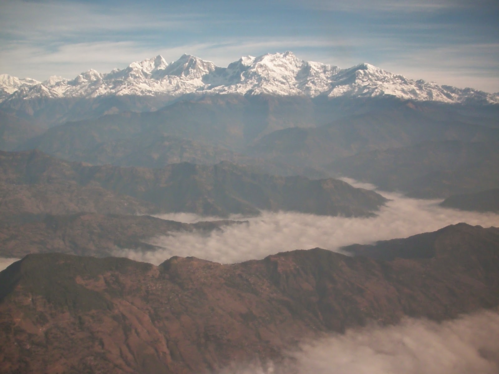
Our plane was slowly descending here. That mountain is able to catch or nurture a huge volume of ice.

Among the lower mountains near Pokhara. Mountain tops have been cleared of trees, there is a road on the ridge and there are houses and pockets of agri plantation. Some trees are able to survive this land conversion from forest to agriculture and human settlements. The trees are on the steep sides of the mountain.

Another view of the deforested or converted mountain.

This may be a rice terraces. The soil looks brown, not green, because the land is on fallow, on rest. It is winter in Nepal, not much water to irrigate the rice and other crops. But it's clear here, total land conversion from forest to non-forest land use, mainly agriculture.

This village practices agro-forestry. Or maybe the rows of trees serve as boundary markers between and among private lands and farms.

Steep elevation is stabilized by having many layers or rows of terraces. There are many houses in this mountain or hill.

White water, on a river below the big lake, and perhaps further below a small hydro plant.

An expanding Pokhara, the valley.

White mountains, blue mountains, white roofs, green river.

A commercial area of the city.

The airport.

I asked Razan to take my photo. :-)

Pokhara being a valley, higher mountains on one side (towards China), lower mountains on this side (towards India).

I really enjoyed that plane ride, among the most scenic rides I experienced. Thanks to Media 9 for that trip.
(Next will be about Pokhara city, its big lake, and our hotel there, Shangrila Village Hotel)
------------
See also:
No comments:
Post a Comment